 |
Matronics Email Lists
Web Forum Interface to the Matronics Email Lists
|
| View previous topic :: View next topic |
| Author |
Message |
Float Flyr

Joined: 19 Jul 2006
Posts: 2704
Location: Campbellton, Newfoundland
|
 Posted: Tue Mar 31, 2009 3:11 pm Post subject: - now Compass Card Posted: Tue Mar 31, 2009 3:11 pm Post subject: - now Compass Card |
 |
|
That is not a problem where 90% of the communities are coastal.  Every light

house is different and you get used to the different bays by shape...  It's

when you move inland and there are few communities, fewer still with water

towers that the fun begins.  Check us out on Google Earth...  One highway,

more or less east west.  Four or five major lakes in the interior and salt

water all round...  kinda hard to get lost..  I've been able to do it on the

ground, sort of.  It took hard work and dedication but we still ended up

where we intended to go about twelve hours late.  In the air fly a cardinal

point until you hit either the highway or salt water.  Once you do you will

know exactly where you are.


Noel


--
| | - The Matronics Kitfox-List Email Forum - | | | Use the List Feature Navigator to browse the many List utilities available such as the Email Subscriptions page, Archive Search & Download, 7-Day Browse, Chat, FAQ, Photoshare, and much more:
http://www.matronics.com/Navigator?Kitfox-List |
|
_________________
Noel Loveys
Kitfox III-A
Aerocet 1100 Floats |
|
| Back to top |
|
 |
Lynn Matteson
Joined: 10 Jan 2006
Posts: 2778
Location: Grass Lake, Michigan
|
| Posted: Wed Apr 01, 2009 2:26 am Post subject: - now Compass Card |
|
|
When I flew to California, I followed I-10 from Hondo, Texas to Yucca
Valley, where I turned north, etc. When I say I use the GPS and the
chart, I use them for guidance, knowing I've got a lake coming up
here, a mountain there, or a town off to the left or right. My flight
instructor told me to use the fence rows and roads as a pretty good
guide for N-S and E-W, but when you get over Kentucky, all bets are
off, as everything down there is based on winding roads and wandering
fence rows.....easier to evade the ATF cops? I'm kidding, all you
Kentuckians, just kidding. : )
Lynn Matteson
Kitfox IV Speedster, taildragger
Jabiru 2200, #2062, 622.1 hrs
Sensenich 62x46
Electroair direct-fire ignition system
Status: flying
On Mar 31, 2009, at 9:31 PM, Noel Loveys wrote:
| Quote: |
No GPS (I generally leave it in the car) and a pencil line with a
2H on the
VNC. I usually mark the magnetic headings I'll use on the chart, (VFR
Navigation Chart) but I fly by the track I visualize on the
ground. I find
when flying a compass bearing I fixate too much on the compass and not
enough outside the plane. If I visualize a track on the ground
then I spend
a lot more time actually flying the plane as opposed to having the
plane fly
me... If you know what I mean. I also spend a lot more time
looking for
other traffic and enjoying the flight.
One of the things I have noticed is the Canadian VNC show water but
not
islands in the ponds. Without the islands marked a lot of the
ponds look
completely different when flying over them. Road maps for some
reason seem
to have the islands showing so it is easier to locate ponds by
shape with
the islands in them.
Noel
|
| | - The Matronics Kitfox-List Email Forum - | | | Use the List Feature Navigator to browse the many List utilities available such as the Email Subscriptions page, Archive Search & Download, 7-Day Browse, Chat, FAQ, Photoshare, and much more:
http://www.matronics.com/Navigator?Kitfox-List |
|
_________________
Lynn
Kitfox IV-Jabiru 2200
N369LM |
|
| Back to top |
|
|
Float Flyr
Joined: 19 Jul 2006
Posts: 2704
Location: Campbellton, Newfoundland
|
| Posted: Wed Apr 01, 2009 4:59 am Post subject: - now Compass Card |
|
|
Around here they call the winding roads the way the cow came home. If you look at Newfoundland on Google Earth you will find most of our hills and to an extent the ponds stretch roughly NNE/SSW with I think it is four major ponds (lakes) flowing east west in the interior of the island.
Noel
--- On Wed, 4/1/09, Lynn Matteson <lynnmatt(at)jps.net> wrote:
| Quote: |
From: Lynn Matteson <lynnmatt(at)jps.net>
Subject: Re: Kitfox-List: Re: - now Compass Card
To: kitfox-list(at)matronics.com
Received: Wednesday, April 1, 2009, 7:55 AM
--> Kitfox-List message posted by: Lynn Matteson <[url=/mc/compose?to=lynnmatt(at)jps.net]lynnmatt(at)jps.net[/url]>
When I flew to California, I followed I-10 from Hondo, Texas to Yucca Valley, where I turned north, etc. When I say I use the GPS and the chart, I use them for guidance, knowing I've got a lake coming up here, a mountain there, or a town off to the left or right. My flight instructor told me to use the fence rows and roads as a pretty good guide for N-S and E-W, but when you get over Kentucky, all bets are off, as everything down there is based on winding roads and wandering fence rows.....easier to evade the ATF cops? I'm kidding, all you Kentuckians, just kidding. : )
Lynn Matteson
Kitfox IV Speedster, taildragger
Jabiru 2200, #2062, 622.1 hrs
Sensenich 62x46
Electroair direct-fire ignition system
Status: flying
On Mar 31, 2009, at 9:31 PM, Noel Loveys wrote:
| Quote: | --> Kitfox-List message posted by: "Noel Loveys" <[url=/mc/compose?to=noelloveys(at)yahoo.ca]noelloveys(at)yahoo.ca[/url]>
No GPS (I generally leave it in the car) and a pencil line with a 2H on the
VNC. I usually mark the magnetic headings I'll use on the chart, (VFR
Navigation Chart) but I fly by the track I visualize on the ground. I find
when flying a compass bearing I fixate too much on the compass and not
enough outside the plane. If I visualize a track on the ground then I spend
a lot more time actually flying the plane as opposed to having the plane fly
me... If you know what I mean. I also spend a lot more time looking for
other traffic and enjoying the flight.
One of the things I have noticed is the Canadian VNC show water but not
islands in the ponds. Without the islands marked a lot of the ponds look
completely different when flying over them. Road maps for some reason seem
to have the islands showing so it is easier to locate ponds by shape with
the islands in them.
p; --> http://www.matronics.com/Navigator?Kitfox-Listhttp://forums.matrobsp; - List Contribution Web Site -http://w=======================
|
|
 Yahoo! Canada Toolbar : Search from anywhere on the web and bookmark your favourite sites. Download it now! [quote][b] Yahoo! Canada Toolbar : Search from anywhere on the web and bookmark your favourite sites. Download it now! [quote][b]
| | - The Matronics Kitfox-List Email Forum - | | | Use the List Feature Navigator to browse the many List utilities available such as the Email Subscriptions page, Archive Search & Download, 7-Day Browse, Chat, FAQ, Photoshare, and much more:
http://www.matronics.com/Navigator?Kitfox-List |
|
_________________
Noel Loveys
Kitfox III-A
Aerocet 1100 Floats |
|
| Back to top |
|
|
Tom Jones
Joined: 12 Mar 2006
Posts: 752
Location: Ellensburg, WA
|
| Posted: Wed Apr 01, 2009 5:34 am Post subject: Re: - now Compass Card |
|
|
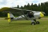
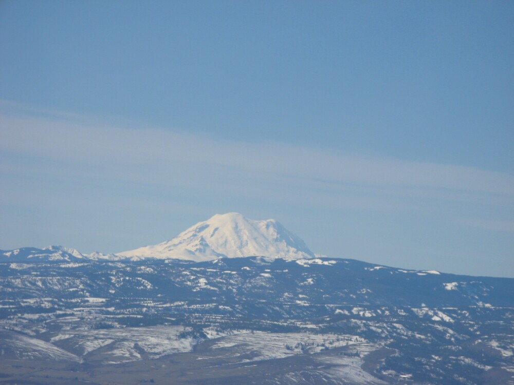
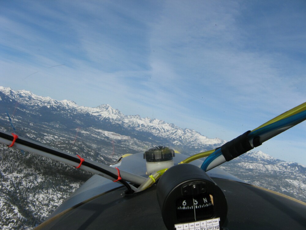
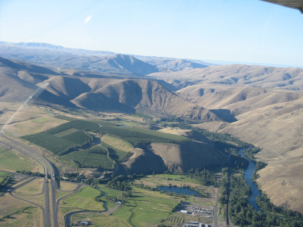
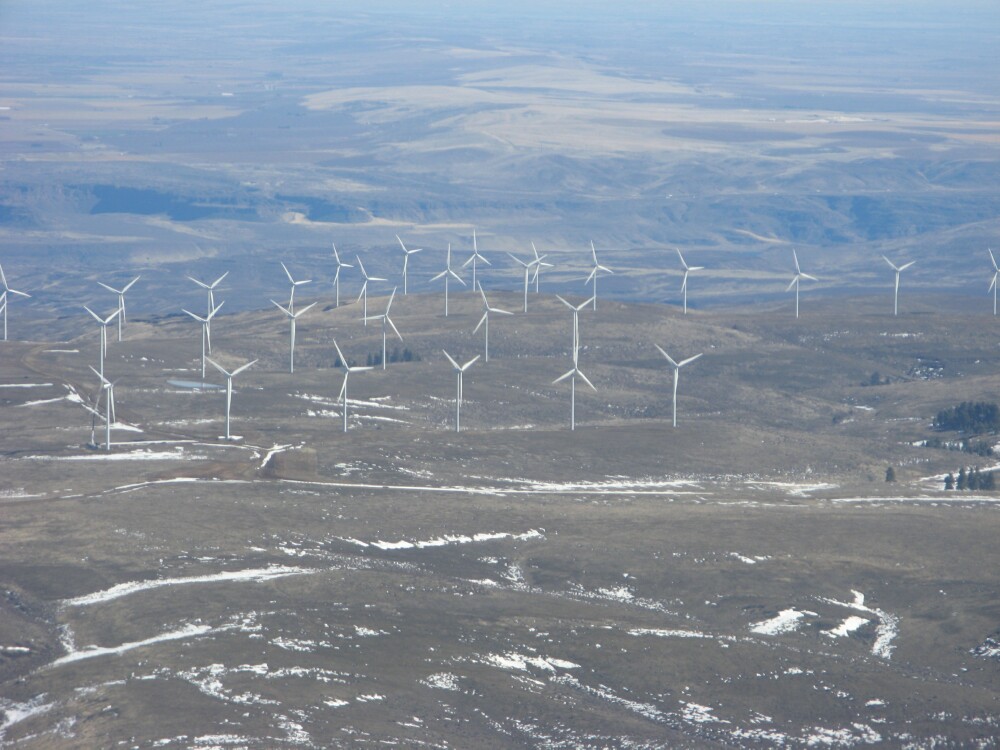
Attached are some pictures of my navigation landmarks. When I see the big white mountain I am heading west. When I see the jagged white mountain range I am headed north. When I see the river canyon I am headed south. When I see the wind mills I am headed east. Sorry, I couldn't resist. Do not archive
| | - The Matronics Kitfox-List Email Forum - | | | Use the List Feature Navigator to browse the many List utilities available such as the Email Subscriptions page, Archive Search & Download, 7-Day Browse, Chat, FAQ, Photoshare, and much more:
http://www.matronics.com/Navigator?Kitfox-List |
|
| Description: |
|
| Filesize: |
96.04 KB |
| Viewed: |
2371 Time(s) |
|
| Description: |
|
| Filesize: |
133.53 KB |
| Viewed: |
2371 Time(s) |
|
| Description: |
|
| Filesize: |
170.77 KB |
| Viewed: |
2371 Time(s) |
|
| Description: |
|
| Filesize: |
159.25 KB |
| Viewed: |
2371 Time(s) |
|
_________________
Tom Jones
Classic IV
503 Rotax, 72 inch Two blade Warp
Ellensburg, WA |
|
| Back to top |
|
|
lcfitt(at)sbcglobal.net
Guest
|
| Posted: Wed Apr 01, 2009 7:06 am Post subject: - now Compass Card |
|
|
---
| | - The Matronics Kitfox-List Email Forum - | | | Use the List Feature Navigator to browse the many List utilities available such as the Email Subscriptions page, Archive Search & Download, 7-Day Browse, Chat, FAQ, Photoshare, and much more:
http://www.matronics.com/Navigator?Kitfox-List |
|
|
|
| Back to top |
|
|
Float Flyr
Joined: 19 Jul 2006
Posts: 2704
Location: Campbellton, Newfoundland
|
| Posted: Wed Apr 01, 2009 11:35 am Post subject: - now Compass Card |
|
|
That white mountain is a lovely land mark!


Noel


--
| | - The Matronics Kitfox-List Email Forum - | | | Use the List Feature Navigator to browse the many List utilities available such as the Email Subscriptions page, Archive Search & Download, 7-Day Browse, Chat, FAQ, Photoshare, and much more:
http://www.matronics.com/Navigator?Kitfox-List |
|
_________________
Noel Loveys
Kitfox III-A
Aerocet 1100 Floats |
|
| Back to top |
|
|
|
|
You cannot post new topics in this forum
You cannot reply to topics in this forum
You cannot edit your posts in this forum
You cannot delete your posts in this forum
You cannot vote in polls in this forum
You cannot attach files in this forum
You can download files in this forum
|
Powered by phpBB © 2001, 2005 phpBB Group
|

